
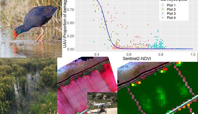
New article: Calibrating Sentinel-2 imagery with multispectral UAV derived information to quantify damages in Mediterranean rice crops caused by western Swamphen (Porphyrio porphyrio)
Objective quantification of damages caused by conservation interest birds in the rice crops of the Ebro Delta to compensate farmers, based on satellite images and drone. An example of science applied to protected areas management. Since 2018, the Catalan Government quantifies in an objective manner […]